+370 686 51148
info@lietuvosgamta.lt
English
English
Lithuanian
HOME PAGE
NATURAL HERITAGE ATTRACTIONS
Stones
Outcrops, conglomerates
Caves, rocks and holes
Partisan torture places
Sand dunes
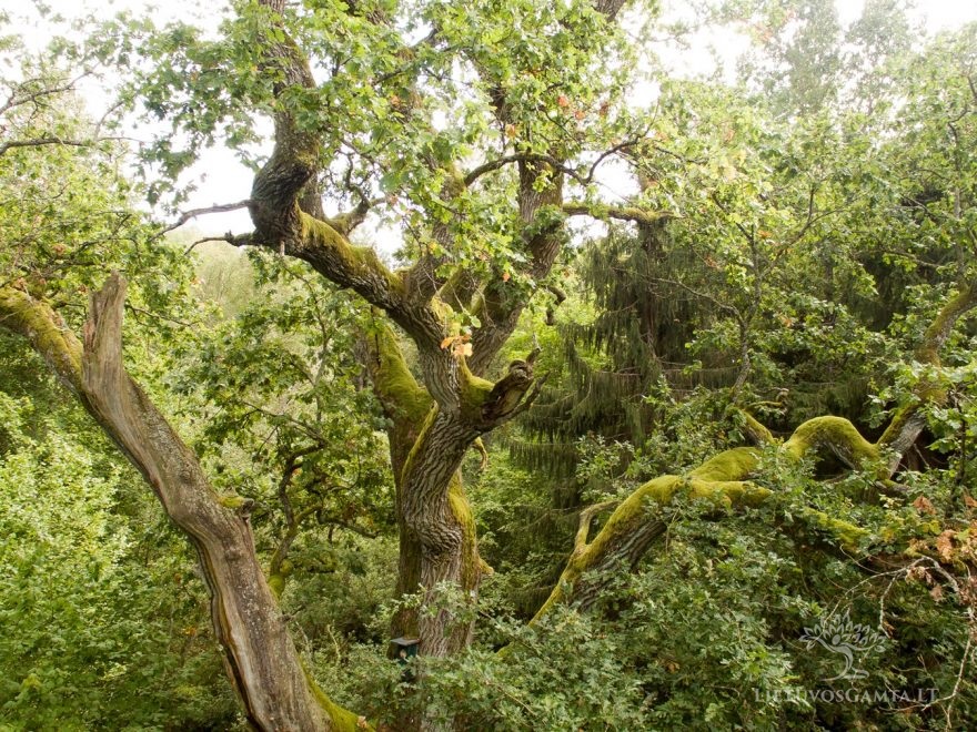
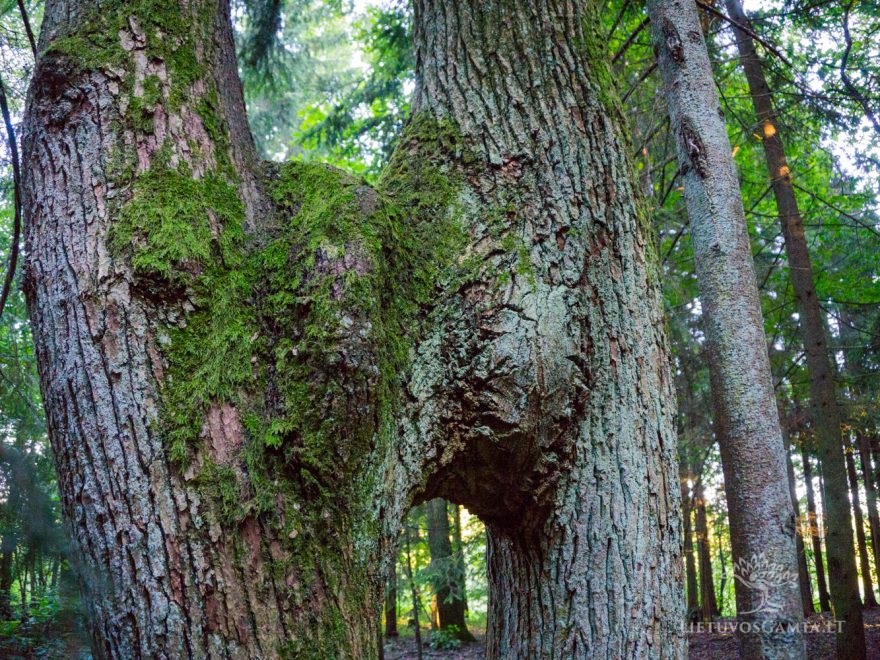
Trees
Parks
Mounds
Islands, peninsulas, cape
Water
MAP
ARTICLES
New project – virtual help for the ones traveling across Lithuania
Exposures Breathing the Past
Take a look from above – The hills, ridges and cliffs of Lithuania
The interesting Lithuania: rocks, caves and pits
Centenarian Lithuanian trees – natural riches preserved by people
The most beautiful islands of Lithuania – pieces of heaven near home
Mounds – a unique heritage of the history of the Balts
Cursed and Blessed – What the Largest Stones of Lithuania are Hiding?
The Parks of the Lithuanian Manors – the Handcrafted Masterpiece of Man and Nature
Springs of Lithuania – what miracles bubble up from the depths of the earth?
Lithuanian dunes – constantly changing fragile beauty
Natural wonders of Dzūkija – what places to visit?
ABOUT THE PROJECT
E-book
CONTACTS
Login
Register
Forgot Password
English
Lithuanian
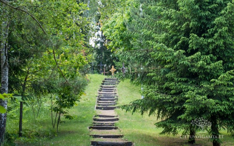
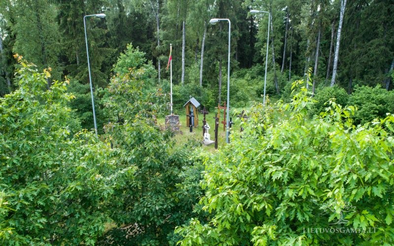
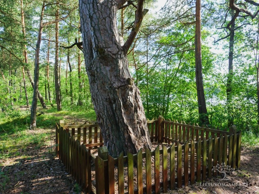
Lietuvos partizanų Kalniškės mūšio vietos kompleksas
54.333930, 23.536156
2324
Share
Add to Favorites
Print
Gallery
Map
Information
Driving
Walking
Bicycling
Transit
Get Direction
Map Direction
Objektas :
Partisan torture places
Municipality :
Lazdijai District
TAGS
Kalniškės mūšio vietos
Kalniškės mūšio vietos kompleksas
Lietuvos partizanų Kalniškės mūšio vietos kompleksas
Lietuvos partizanų mūšio vietos kompleksas
mūšio vietos kompleksas
partizanų mūšio vietos
Attribute
Comments
Search
CLOSE
Natural Heritage Attractions
Islands, peninsulas, cape
Mounds
Mountains, ridges, cliffs
Outcrops, conglomerates
Parks
Partisan torture places
Sand dunes
Stones
Trees
Water
Attractions types
Municipality
Alytus County
Druskininkai City
Lazdijai District
Varena District
Kaunas County
Birštonas City
Kaišiadoris District
Kaunas City
Kauno District
Prienai District
Klaipėda County
Klaipėda City
Klaipėda District
Kretinga District Municipality
Neringa District
Palanga City
Šilutė District
Marijampolės County
Šakiai District
Tauragės County
Jurbarkas District
Telšiai County
Plungė District
Telšiai District
Utenos County
Anykščiai District
Ignalina District
Molėtai District
Utena District
Zarasai District
Vilniaus County
Širvintai District
Trakai District
Vilnius City
Vilnius District
Destination to Vilnius
Search
SEARCH
NATURAL HERITAGE ATTRACTIONS
Stones
Outcrops, conglomerates
Mountains, ridges, cliffs
Sand dunes
Trees
Parks
Partisan torture places
Mounds
Islands, peninsulas, cape
Water
Municipality
Alytus County
Kaunas County
Klaipėda County
Marijampolės County
Tauragės County
Telšiai County
Utenos County
Vilniaus County
Related Listings
FEATURED
Brother of Puntukas
55.509391, 25.071159, 29171, Lie...
Koordinatės:
55.509391, 25.071159
FEATURED
Puntukas Stone
Puntukas, 29168, Lietuva
Koordinatės:
55.484007, 25.059580
Agila Dune
55.439002, 21.080810
Koordinatės:
55.439002, 21.080810
Antakmenė Conglomerate
55.438901, 26.242756
Koordinatės:
55.438901, 26.242756
Asalnai Pine
55.354722, 26.061389
Koordinatės:
55.354722, 26.061389
Auksalės pusiasalis
56.017094, 21.842814
Koordinatės:
56.017094, 21.842814
Balbieriškis Estate Park
54.51627, 23.89346
Koordinatės:
54.51627, 23.89346
Balbieriškis Exposure
54.534311, 23.883497
Koordinatės:
54.534305, 23.883475
Baluošo Ilgasalė
55.394167, 26.050000
Koordinatės:
55.394167, 26.050000
Bėčiūnai Oak
55.322678, 26.180273
Koordinatės:
55.322678, 26.180273
Beržoro ežero sala
56.02056, 21.81861
Koordinatės:
56.02056, 21.81861
Blind Lake Vokštelis
55.874524 , 22.357114
Boulder “Dievo stalas̶...
55.866536, 22.113439
Koordinatės:
55.866536, 22.113439
Ožkų pečius exposure
54.611863, 24.070534
Koordinatės:
54.611863, 24.070534
Stone Daubos kūlis
56.121362, 21.273545
Koordinatės:
56.121362, 21.273545
The Cockerel stone (Akmuo Gaidel...
54.996972, 24.099194
Koordinatės:
54.996972, 24.099194
The Oak Balčiai
55.655488, 25.964450
Koordinatės:
55.655488, 25.964450
The Oak of Alkūnai
55.101220, 25.548841
The Twin Oaks
56.071996 , 21.902057
Koordinatės:
56.071996 , 21.902057
The Witch’s Throne (Ragano...
55.683700, 26.416250
Koordinatės:
55.683700, 26.416250